“Supports GNSS” does not define a survey result. A useful procurement decision must connect the receiver and antenna, correction source, position status, coordinate reference system, antenna height, field procedure and required deliverable. DGNSS or RTK labels describe positioning methods; they do not by themselves prove that a collected point meets the project requirement.
This guide is for GIS teams, survey-support integrators and buyers of Rugged Android & Windows Tablets deciding between built-in location and an external receiver. It separates general asset location from work that requires controlled coordinates and documented quality evidence. It does not establish survey-grade accuracy for an AIDC GO tablet or receiver without model-specific data.
Start with the deliverable, not the receiver badge
Define what the project must deliver: a map pin for finding an asset, a GIS feature with stated horizontal quality, or a survey observation that must enter a controlled network. Name the required coordinate reference system, horizontal and vertical outputs, units, metadata and acceptance rule. “Centimetre accurate” is not a complete specification without confidence, environment and field method.
Built-in tablet positioning may be appropriate for navigation or general asset capture when the project accepts that result. A controlled GIS or survey task may require an external multi-frequency receiver, calibrated antenna, correction service and field software. The Rugged Tablets page helps select the computer platform; it is not evidence of a specific GNSS accuracy.
Use the Rugged Tablet Field Operations page to connect the positioning task with forms, interfaces, mounting and deployment. Keep the positioning acceptance criteria in the project brief rather than assuming the display device determines the coordinate quality.
Specify map viewing or record collection before buying an offline package
Before comparing the tablet and receiver, specify what the worker must do without a connection. Opening a prepared map to find a work location is different from creating or changing a feature, completing its fields and attaching evidence. The same display can support either task, but an offline map deliverable does not automatically include an editable collection workflow. Define the required operation and receiving record as well as the positioning quality.
As a named third-party example, Esri’s Field Maps guidance, updated June 17, 2026, distinguishes downloaded map areas from mobile map packages (MMPKs). In that documented workflow, downloaded map areas can support viewing and collecting data offline; MMPKs are read-only and do not support data collection. Verify the exact application version, map format, layer settings and permitted operation in the proposal. This example does not describe every GIS client or establish AIDC GO software supply, licensing or compatibility.
Consider an illustrative quotation comparison, not real offers. Both packages say “offline maps included.” One supplies a prepared read-only package; the other includes configuration for the required editable map, fields and attachment delivery. If the team only needs reference viewing, it need not buy collection work it will not use. If it must return new observations, agree who prepares the map and layers, establishes the required account permissions, configures the collection client and confirms that synchronized records reach the receiving system. Keep any software entitlement and configuration work explicit rather than inferring them from the tablet price.
Test the proposed route with one representative offline task. For viewing, open the required area and inspect the detail the worker needs. For collection, create an authorized test record, enter its required fields, attach the required evidence, close and reopen the client, then synchronize under the application’s documented workflow and inspect the receiving record. This tests the delivered map operation, not coordinate accuracy or every offline function. Retain the receiver, correction and reference-system checks below; a better receiver cannot turn a read-only map package into an editable client.
Separate autonomous GNSS, DGNSS and RTK
An autonomous GNSS position is computed from satellite signals available to one receiver. GPS names one satellite constellation; GNSS is the broader term for satellite navigation systems and combinations. DGPS therefore means differential GPS, while DGNSS is commonly used for differential positioning with GNSS more generally.
ESA's DGNSS fundamentals explains that classical DGNSS uses a known reference position to determine and broadcast corrections and that the user receiver must support the method and remain within conditions where the errors are sufficiently correlated. NOAA NGS defines DGPS as a code-based GPS technique on printed page 62 of its real-time positioning guide, while the next definition says “differential positioning” can also cover the more precise carrier-phase baseline techniques used in GNSS surveying. This article compares the common code-observation differential case with carrier-phase RTK; it does not redefine every use of DGNSS as code-only.
RTK uses carrier-phase observations and real-time corrections from a base station or network. NOAA NGS's real-time GNSS positioning guidelines describe differential positioning on printed page 62 (PDF page 68) and RTK in its real-time surveying terminology; the current NGS OPUS Projects glossary also describes RTK as a differential GNSS technique. RTK is therefore not outside differential positioning merely because it uses carrier phase. The documents emphasise field procedure and verification rather than treating a status label as the result.
For procurement, ask which correction method is used, which receiver output identifies the solution state, and how corrections reach the receiver or application. “Supports DGPS” is not enough without the correction source, interface, status fields and acceptance rule for the proposed configuration.
The correction path is part of the configuration. Record the service or base, message format, network account, communications link, mount point or stream, geographic coverage and what happens when corrections age or stop. A receiver displaying satellites is not proof that it is consuming the intended corrections.
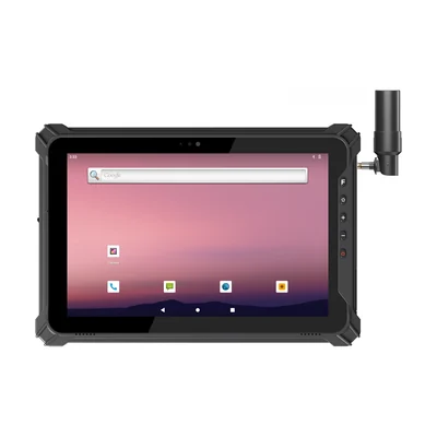
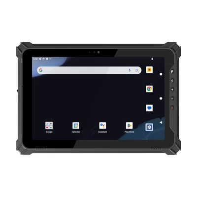
The RT-T17X-RTK lists integrated RTK as standard, and the RT-V12R vehicle tablet lists an RTK positioning module as an option.
Account for antenna, height and reference frame
The measured point is not automatically the point represented by the receiver's raw coordinate. NOAA's GNSS antenna calibration service provides calibrations for named antenna and radome combinations and warns that processing products should use a consistent reference frame. The antenna model and calibration therefore belong in the evidence record.
Antenna height and measurement method also matter. NGS's OPUS guidance asks for the antenna type and the vertical height of the antenna reference point above the mark. It also allows a State Plane Coordinate System zone to be selected. These inputs illustrate why a coordinate without antenna and reference-system metadata can be unusable for the intended deliverable.
For a named external receiver, follow the vendor's exact measurement point and software instructions. Trimble's 2025.20 General Survey user guide warns that the correct antenna height and measurement method are important to the computed result for supported receiver workflows. This is a vendor-specific example, not an AIDC GO configuration claim.
Compare two editorial field tasks
Task A is an editorial maintenance inventory. A technician records the approximate location of a cabinet so colleagues can find it later. The application stores latitude, longitude, capture time and an indicated quality value from the tablet. The acceptance rule is operational: the point and site description must lead another worker to the correct cabinet. It does not establish survey control.
Task B is an editorial utility-mapping project with a defined coordinate reference system and a stated project tolerance. The tablet connects to a named external receiver and antenna, receives corrections from an specified service and records antenna height, solution type, correction age, satellite and quality metadata. The field procedure includes an independent check point and a repeated observation under the project's method.
If corrections stop during Task B, the application does not silently label the next point as equivalent. It records the status change and correction age, applies the project's hold or reject rule and identifies observations requiring repetition. If the field file uses the wrong coordinate system, the team corrects the workflow and recollects or transforms data under the project authority rather than moving points by eye.
These examples show different acceptance contracts. Task A may be useful with a general location result; Task B needs a complete, controlled positioning chain. Neither scenario is an AIDC GO field test or a promise of a specific accuracy.
Record what each observation establishes
| Item | Evidence to retain | What it cannot prove alone |
|---|---|---|
| Receiver and antenna | Exact models, firmware, antenna/radome code, connection and mount | This does not prove corrections, coordinate settings or field procedure were correct. |
| Correction service | Source, message/stream, account, connection times and correction age | This does not prove that every accepted point met the project tolerance. |
| Position status | Raw solution type, quality indicators, time and environment | This does not prove accuracy merely because the display said fixed or differential. |
| Reference system | Datum/reference frame, projection, geoid or height model, units and transformation | This does not prove the antenna height or output mapping was correct. |
| Field verification | Check point, repeat observation, residuals and acceptance decision | This does not extend the result to a different site, configuration or procedure. |
NOAA's GNSS Vector Exchange format illustrates the breadth of useful metadata for GNSS vectors, including reference-frame information, receiver and antenna types, RTK/RTN settings and quality-control fields. A project does not need to use GVX to learn from that principle: retain enough context to reproduce and audit the decision.
Turn the requirement into a purchase and acceptance plan
Give the supplier the required deliverable, project region, coordinate system, target software, tablet or host platform, receiver and antennan option, correction source, field environment, mounting method and interface. Ask which exact hardware, firmware, accessories, drivers and software versions apply. Ask the correction provider to confirm coverage and account requirements separately.
The project owner should define the acceptance method: known check points, repeat observations, status and correction-age limits, antenna-height recording, coordinate validation and treatment of interrupted sessions. The supplier can document the equipment; the project authority decides whether the resulting evidence meets the intended GIS or survey use.
Use Integration & Support to request interface and version material for a named tablet/receiver combination, and contact AIDC GO with the project country, host device, application and positioning evidence required. A defensible choice specifies the full configuration and the result to be accepted instead of treating “GNSS,” “DGNSS” or “RTK” as a self-contained capability.
Devices for this workflow